Live data from Hacker News

Maps distort how we see the world

unchartedterritories.tomaspueyo.com

201–210 of 351 posts

Re: Maps distort how we see the world

#201
post #79

Earlier quoted context omitted.

it’s a huge stretch to claim there was no bias involved. the biais is in putting europe front and center and at the top. Have you seen maps that place the americas in the center? How about maps with north and south swapped?

Maybe more accurate is that there wasn’t some nefarious bias that was meant to oppress people. Europe was at the center because they made the maps. It’s a simple reason. If some other culture has been dominant we’d be using a projection that makes it more useful for them.

I'd argue that, by coincidence, putting Africa/Europe in roughly the centre happens to be the most sensible. Extraterrestrials with no knowledge of humans would probably do this.

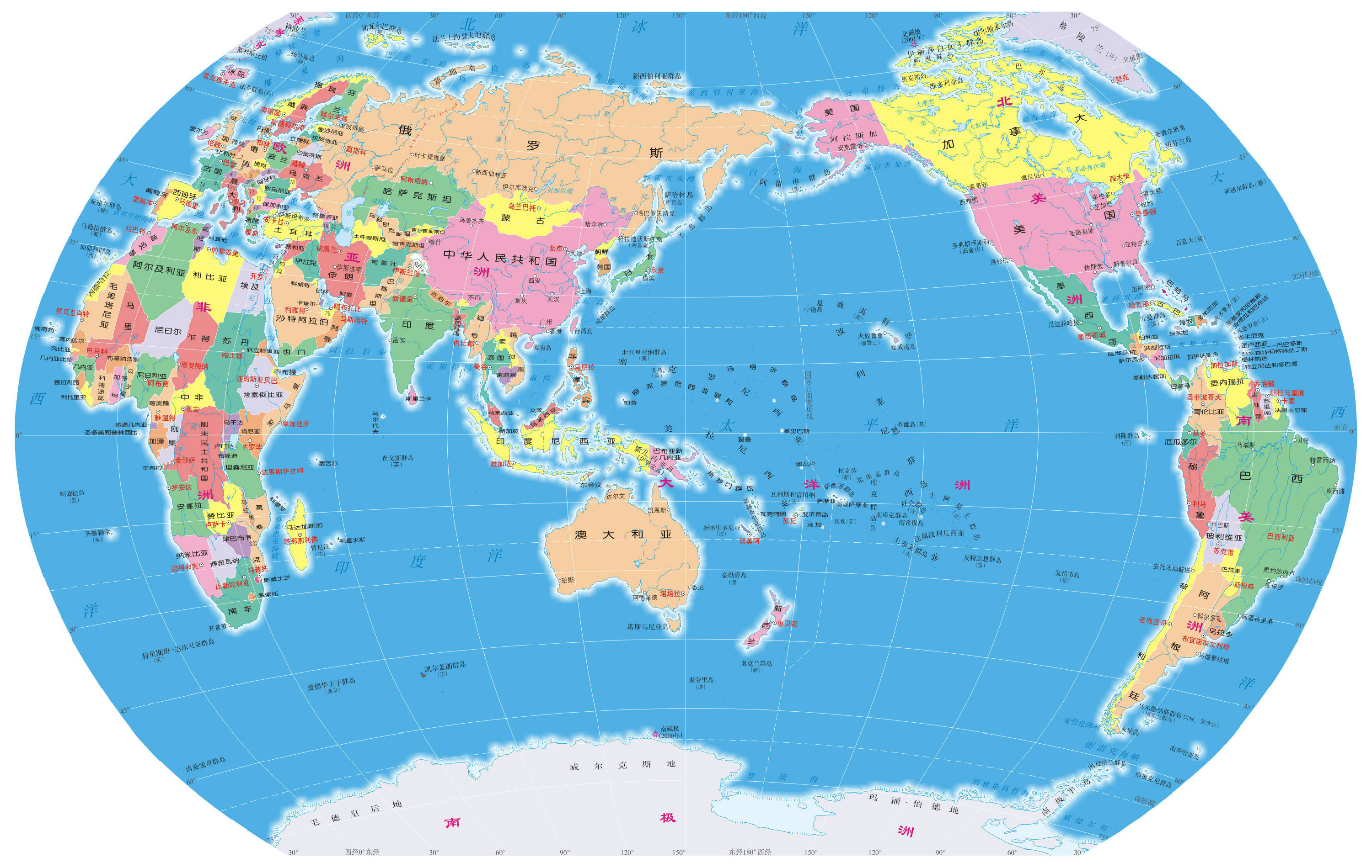
The reason for this is that it's the most "geographical centric" location, with the Americas to the left and Asia to the right, with the huge pacific ocean pushed to the edges. If you place China in the centre then you're "wasting" a lot of space on the pacific. I think [1] is a worse map because significant parts of the world are pushed to the edge in favour of the pacific, which takes centre stage.

You also see this if you zoom out on Google Maps as far as it will allow, putting Africa/Europe in the centre still shows you most of the world's landmasses, but if you put China in the centre it's almost as if the Americas haven't been discovered yet.

[1]: https://studycli.org/wp-content/uploads/2021/03/china-world-...
Re: Maps distort how we see the world

#202
Distorts nothing, it gives a particular view of the world. All our views of the world are highly localised by the very nature of our existence.

We can form our own maps by our experience but this is going to be naturally very limited and so maps provide us means to transmit a biased view of the world. All of these views will be biased in some fashion that's the nature of existence.

Re: Maps distort how we see the world

#203
post #79

Earlier quoted context omitted.

it’s a huge stretch to claim there was no bias involved. the biais is in putting europe front and center and at the top. Have you seen maps that place the americas in the center? How about maps with north and south swapped?

Maybe more accurate is that there wasn’t some nefarious bias that was meant to oppress people. Europe was at the center because they made the maps. It’s a simple reason. If some other culture has been dominant we’d be using a projection that makes it more useful for them.

Maybe instead of putting Europe in the middle we could do something sensible like put the split left-right edges down the middle of the widest ocean.

Re: Maps distort how we see the world

#204

All maps are created with selective purpose. The only thing that can possibly represent all purposes simultaneously is the world itself. Accordingly, every map is also a compromise.

More generally: All models are wrong, but some are useful.

-- George E. P. Box, in "Science and Statistics" (1976) https://www-sop.inria.fr/members/Ian.Jermyn/philosophy/writi...> (PDF)

See: https://en.wikipedia.org/wiki/All_models_are_wrong>

Box apparently expanded on the notion in Box, G. E. P. (1979), "Robustness in the strategy of scientific model building", in Launer, R. L.; Wilkinson, G. N. (eds.), Robustness in Statistics, Academic Press, pp. 201–236, doi:10.1016/B978-0-12-438150-6.50018-2, ISBN 9781483263366.

Full text online at https://pure.au.dk/ws/files/224156357/skogen_etal_2021_meps....> (PDF)

Re: Maps distort how we see the world

#205
post #141

Earlier quoted context omitted.

Agree. Most of the general-public wall maps I see out there use equal-area projs.

Really? In my entire lifetime I’ve seen maybe five? Including the one hanging up in my childhood home. Even Google Maps uses Mercator by default.

I wonder how much location bias affects this. I also grew up with basically only seeing equal-area projections and globes -- that's just what my school district used. It was weird seeing all the online memes about Mercator when I grew up never seeing it, heh.

Re: Maps distort how we see the world

#206

The overlay of Canada on Europe is always a fun one. We moan so much here (perhaps rightfully so) about lack of public transit and reasonable infrastructure to get around, but we're also comparing a population of (just recently hit!) 40,000 and ~700,000. Orders of magnitude larger, but roughly same land area. This is why I am hugely in support of increased immigration into Canada, housing crisis aside (it'll resolve…

NB: Canada is 40 millions, not thousands. Likewise Europe (variously defined) is 700 million.

Re: Maps distort how we see the world

#208
post #105
post #94

Earlier quoted context omitted.

> The trade-offs between different projections are rarely discussed, considered or even mentioned outside very small cohorts Not true. They're honestly discussed all the time to the point of becoming tiresome.

Right? Is there a person above 25 that hasn’t seen the episode (or clip) from The West Wing about map projections at this point?

As an adult I was shocked to find out how the projection I grew up with altered my perception of my poverty-stricken country. I had no idea for my entire life that it was so much larger than other countries on the map I thought were larger. I doubt I am rare here at all.

And I have no idea what "The West Wing" is. And I doubt I am rare here at all also.

Re: Maps distort how we see the world

#209
post #24

Every flat map projection distorts something, so every projection has to optimize some parameter and trade off other utility. I'm constantly amazed at how hung up people are on apparent size of countries. If size is your thing, use some other projection! Mercator is and remains popular because it preserves local angles and shapes, which makes it simple use this projection to navigate by rhumb lines (compass headings)…

I think that obsession you are referring to is part of a far larger mental illness that is coursing through European minds and cultures; the constant, compulsive obsession with trying to find the most obscure and ridiculous reasons, causes, and excuses for how brown people are Noble Savage victims and Europeans must hate themselves.

This time the reason why Europeans must hate and destroy themselves is … spins the wheel … that maps are flat and the planet is not.

European people and culture all over that planet is very mentally sick and self-destructive. Any individual person that exhibited even slightly as mentally ill mentalities as Europeans, we would immediately seek help for them.

Re: Maps distort how we see the world

#210
post #141
post #84

Earlier quoted context omitted.

> Out of the millions of decorative world maps on walls, kids with maps to learn the world, world maps on the news, maps used in data visualization charts etc., non of those are using the map for "navigation" yet they still use Mercator projection simply because "that's the right shape of the world" regardless of what "right" means I question what percentage of those maps in reality are actually Mercator? I feel this…

Agree. Most of the general-public wall maps I see out there use equal-area projs.

What country do you live in? If I visit there I'll look out for them because I see equal-area projs like never. Even the decorative one in my room right now clearly has Greenland look more than half the size of all of Africa.
Post reply on HN