I see a whole new business category being born: Nausea as a Service!
Inception-style curved map for turn-by-turn directions
31–40 of 199 posts
Re: Inception-style curved map for turn-by-turn directions
#32[dead]
Re: Inception-style curved map for turn-by-turn directions
#33Beautiful perspective if you need to take a left in 500 meters. Not so great if you have to take a left in 3 kilometers because that would just not be visible.
Now of course you could change the parameters so that the upper screen border is 3 kilometers. But normal standard perspective is even better, because it can show you up to infinity. The inherent concept here is that there is a cut-off at the top, and that there is always a lot of unnecessary stuff near you whizzing by to look at / dopamine kicks. So you would have to constantly look at the screen - instead of at the road.
Navigon (among others) back in 2009 showed a perspective that balanced between showing the next junction and the next few kilometers. And leaving out anything unnecessary. I like that better. Example: https://www.notebookcheck.com/fileadmin/_processed_/csm_Garm...
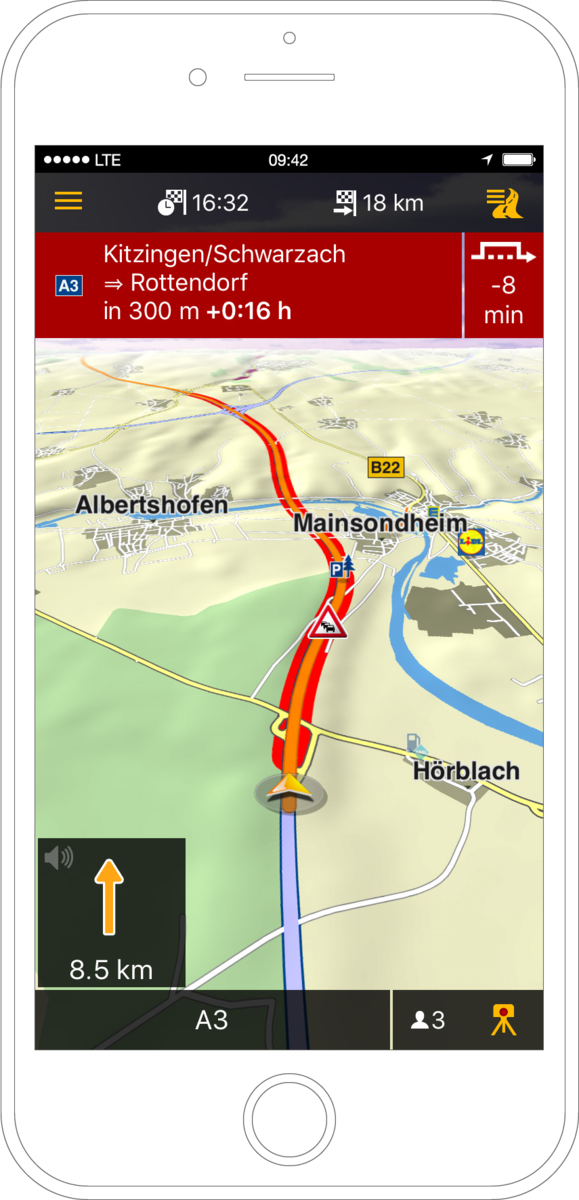
Re: Inception-style curved map for turn-by-turn directions
#34Absolutely honest question: what is the advantage of this over a top view navigation with the orientation following the orientation of movement? Am I missing something?
You can calibrate navigation to visual landmarks, i.e. you can see the turn coming up and match it to what you see out your window. But you also still get an overhead "what lies ahead" map for planning your route further out. This is an interesting concept, maybe a hybrid approach would be useful, a simple overhead streets map as default that swaps to the 3rd person view when you approach your turn.
Re: Inception-style curved map for turn-by-turn directions
#35Absolutely honest question: what is the advantage of this over a top view navigation with the orientation following the orientation of movement? Am I missing something?
If you've ever been confused about which turn is which with top down navigation, then this is for you. While driving a car, being able to at a glance know exactly what turn is what would have saved me countless wrong turns, my parents probably doubly so.
One classic: there's a fork in the road on the way to my parents. One side is "straight", the other side is an exit. I took the wrong, exit side of that several times while my app said to go straight before I just knew the route and didn't need GPS at all. Top-down isn't as good in these cases because of densely packed roads and back to back exits.
That said, it's "good enough" and I doubt this takes off.
Re: Inception-style curved map for turn-by-turn directions
#36Beautiful perspective if you need to take a left in 500 meters. Not so great if you have to take a left in 3 kilometers because that would just not be visible. Now of course you could change the parameters so that the upper screen border is 3 kilometers. But normal standard perspective is even better, because it can show you up to infinity . The inherent concept here is that there is a cut-off at the top, and that th…
The trick would be adapting relatively, which a lot of apps already do... zoom/flatten out if it's a long stretch of nothing, back in when you start approaching more complicated sections.
Re: Inception-style curved map for turn-by-turn directions
#37What the hell is "right drag"?
Re: Inception-style curved map for turn-by-turn directions
#38That's almost perfect.
Proposal: The use case is to inform the user of landmarks on the route before they need them, giving visual cues about the scenery.
It's missing an early distortion along the direction of the turn though, each turn feels jarring and drops the useful spatial awareness aspect.
Re: Inception-style curved map for turn-by-turn directions
#39Very cool idea. I was on board until the first turn, then I just felt seasick.
Re: Inception-style curved map for turn-by-turn directions
#40Would love this for walking around nyc