While I don't use Organic Maps as my daily driver because there is no traffic data, it has been invaluable to have on my phone. It is one of the best offline and trail maps I've used.
Organic maps: Experimental feed based public transport mapping
11–20 of 36 posts
Re: Organic maps: Experimental feed based public transport mapping
#12The document doesn't say which routing engine is used. I'm currently integrating Motis on a similar initiative (a french open source Web map, https://cartes.app ). More is needed to provide a full transit map experience, but Motis does the essential part. We're not far from transit calculation as an open source commodity in countries that publish their transit data as GTFS. E.g. in France there is a whole team called…
> Organic Maps have very beautiful transit lines representation in the style of Transit app's great work.
I've just opened up Chicago in Organic Maps and it isn't anything like Transit app: https://u.ale.sh/omaps-chicago-loop.jpg
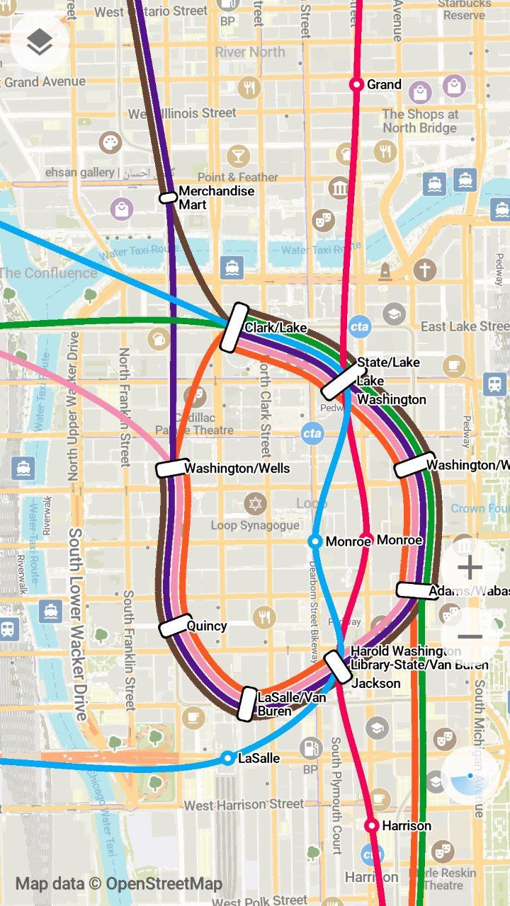
It works great for simpler transit systems, but certainly there’s some room for improvement!
Re: Organic maps: Experimental feed based public transport mapping
#13Related, shouldn't it be possible to get data from rail signalling radios, and infer when a train is blocking a level crossing, and mark a temporary closure on that road so traffic is routed around it? In the US at least, trains sometimes block crossings for upwards of 10 minutes, and it can be very worthwhile to drive around. Doubly so if you could know en-route and seamlessly reroute, rather than having to approach…
Nearly all level crossings are required to, at the very least, trigger a signal with audible sounds and possibly gates, so you just need that same switch to update some online status.
Many crossings in th US actually do not have any warning lights or gates, the only warning of an approaching train is the horn from the locomotive. Low-traffic (either in terms of cars or trains) crossings are often unsignaled.
Re: Organic maps: Experimental feed based public transport mapping
#14This looks incredibly promising.
Having only subway options (and not all of them) in the cities I've been traveling is was a good start, but just adding buses would be a tremendous increase in quality of life... no more going through all the buggy and slow local transit websites.
(Why do local transit authorities think it makes sense to front-load several MB of media files on the homepage of their route-finding website, and load the "itinerary" component last? This is beyond me)
Re: Organic maps: Experimental feed based public transport mapping
#15Does this mean that the routing will happen on the app? This might be a bit resource intensive, but great feature (especially since it will work offline!)
It is definitely resource intensive, but not as much as you would expect. Especially considering the fact that the route only gets calculated once and most modern phones are pretty fast, it won’t really drain your battery.
Re: Organic maps: Experimental feed based public transport mapping
#16Does this mean that the routing will happen on the app? This might be a bit resource intensive, but great feature (especially since it will work offline!)
It is definitely resource intensive, but not as much as you would expect. Especially considering the fact that the route only gets calculated once and most modern phones are pretty fast, it won’t really drain your battery.
Context: just benchmarked it with across-the-US routes and it seems fine
Re: Organic maps: Experimental feed based public transport mapping
#17While I don't use Organic Maps as my daily driver because there is no traffic data, it has been invaluable to have on my phone. It is one of the best offline and trail maps I've used.
Agreed. I can’t believe how it’s better than any other hiking app (particularly free ones but I tried some non free ones too), but it is.
For me the winning feature is the UX around dropping a pin and routing to it via trails just works and is very easy, and includes elevation gain etc. Too many hiking apps require you to navigate along fixed trails in their hike database.
Re: Organic maps: Experimental feed based public transport mapping
#18The document doesn't say which routing engine is used. I'm currently integrating Motis on a similar initiative (a french open source Web map, https://cartes.app ). More is needed to provide a full transit map experience, but Motis does the essential part. We're not far from transit calculation as an open source commodity in countries that publish their transit data as GTFS. E.g. in France there is a whole team called…
> Organic Maps have very beautiful transit lines representation in the style of Transit app's great work. I've just opened up Chicago in Organic Maps and it isn't anything like Transit app: https://u.ale.sh/omaps-chicago-loop.jpg It works great for simpler transit systems, but certainly there’s some room for improvement!
Not sure about your harsh comparison. Organic's version is less of a rectangle, but is very lisible as well.
Re: Organic maps: Experimental feed based public transport mapping
#19Does anybody know if there's an Organic Maps equivalent for cycling?
OSM has a lot of data that's only available in everything-maps like OsmAnd, such as location of bicycle parking spaces or quality of cycle lanes. It would be nice to have it in a nicer interface than that app.
I'm currently building a bike + public transit directions engine (bringing your bike on the train). I'm surprised that this doesn't exist yet; it's my favourite way to get around!
Re: Organic maps: Experimental feed based public transport mapping
#20Does anybody know if there's an Organic Maps equivalent for cycling? OSM has a lot of data that's only available in everything-maps like OsmAnd, such as location of bicycle parking spaces or quality of cycle lanes. It would be nice to have it in a nicer interface than that app. I'm currently building a bike + public transit directions engine (bringing your bike on the train). I'm surprised that this doesn't exist yet…
Organic Maps does include bicycle parking POIs. Also some local transit apps do have bike+train routing options for bike carriage and bike sharing: https://anachb.vor.at/
I agree though that something like this is missing in the offline-first maps space.