Roman Roads (2017)
sashamaps.net
Roman Roads (2017)
1–10 of 166 posts
Re: Roman Roads (2017)
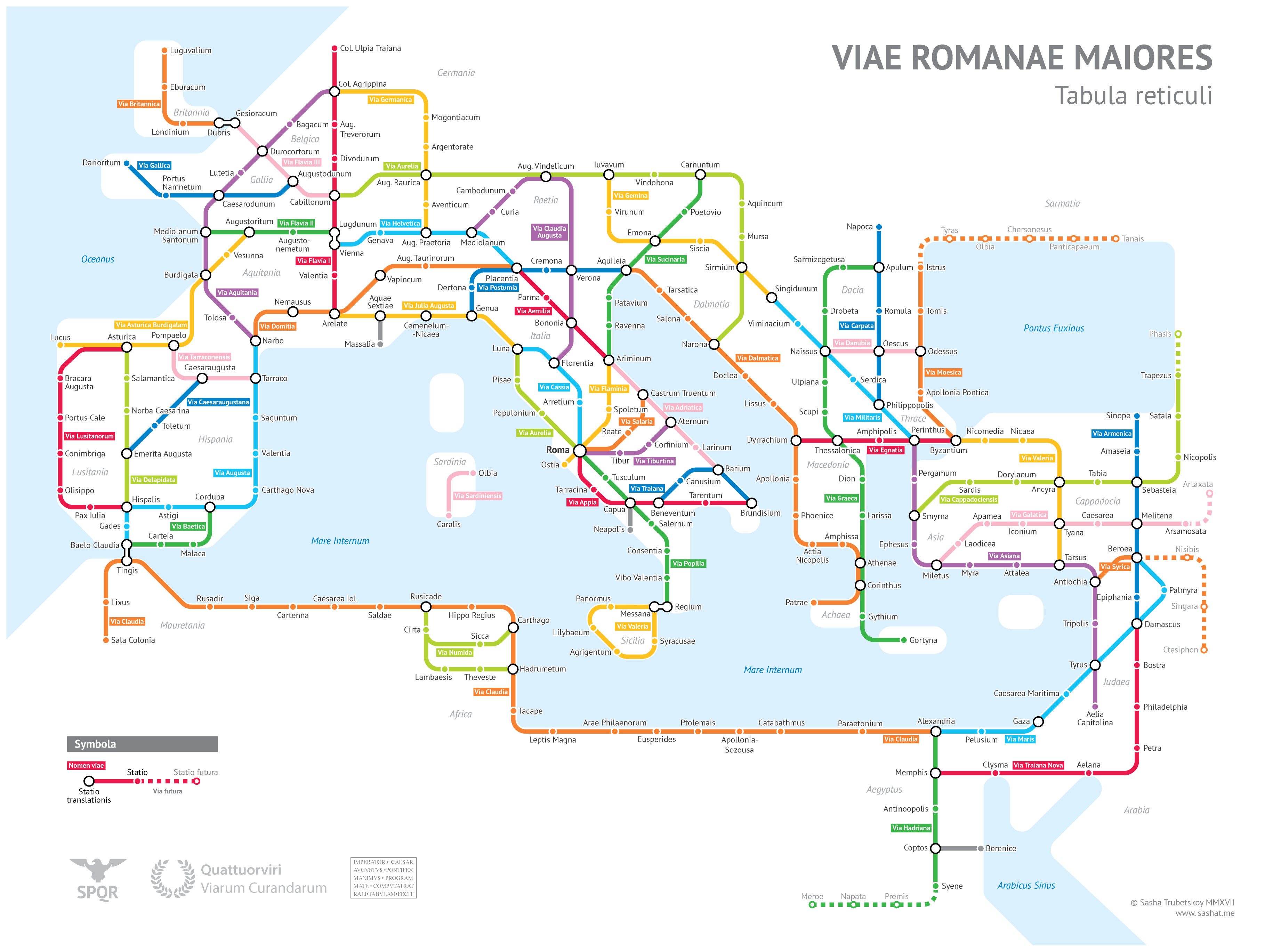
#2That's really well done! I have no comment on the accuracy but it really highlights just how the Romans integrated new areas into the central empire through transportation (goods, ideas, and armies).
I will also call out the road in Africa called "Caeserea lol"
Re: Roman Roads (2017)
#3Much better resolution:
https://video-images.vice.com/articles/593594e8c270a8484d1d1...
Re: Roman Roads (2017)
#4The original creator's page is: https://sashamaps.net/docs/maps/roman-roads-original/
The summary here links right to the original content. I just wanted to highlight the original for the sake of other readers clicking through quickly. There's also a much more detailed (and more interesting) writeup on the creator's page.
Re: Roman Roads (2017)
#5That's really well done! I have no comment on the accuracy but it really highlights just how the Romans integrated new areas into the central empire through transportation (goods, ideas, and armies). I will also call out the road in Africa called "Caeserea lol"
That would presumably be the city of Caesarea in Mauretania[0] which was the capital of that province. According to the Wikipedia article for the modern town at that site[1], it was also called Iol in ancient times.
Re: Roman Roads (2017)
#6LOL, Pompeii (closed)
Re: Roman Roads (2017)
#7How can it take 2 months on foot, yet only 1 month per horse, when a horse can only travel between 25-35 miles a day, which is not twice as far as a human can travel in a day, but about equal?
Re: Roman Roads (2017)
#8There's a missing road in Sardinia that I'm aware of, connecting Karalis (today's Cagliari) with Turris Libisonis (today's Porto Torres, near Sassari).
Re: Roman Roads (2017)
#9Omnes viae Romam ducunt.
Re: Roman Roads (2017)
#10Sometimes I wonder if we've regressed in terms of attention to quality. Here in the US, I see lots of potholes on the streets and sidewalks. Meanwhile, the ancient cobblestone roads are still functional to this day.