Live data from Hacker News

The Decline of the City Grid

economist.com

101–110 of 212 posts

Re: The Decline of the City Grid

#101

The big recent exemplar of street layout for a new place is Houten in the netherlands [0] which is basically focussed on a train station and walkable town square at the centre with a ring road at the edge. Roads are a 'soft grid' for pedestrians and cyclists but stopped up for cars making the car network more of a tree with dead ends rather than a grid. And making road speeds slow at the centre and fast at the edges.…

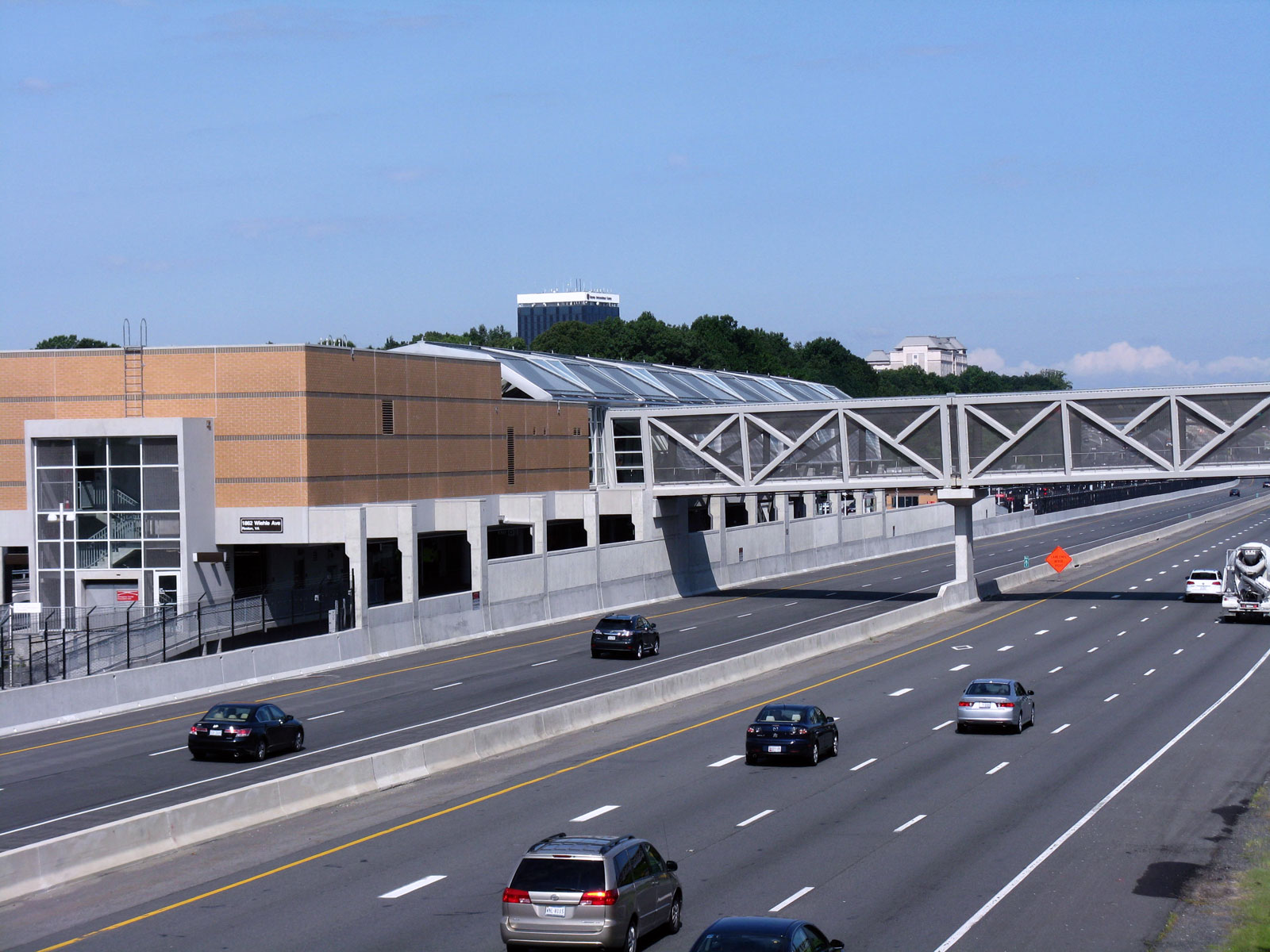
Look at how human scale everything is, even the pedestrian underpass under the road. By contrast in the US, even public transit has to be built at massive, oppressive scales, with pedestrian walkways soaring multiple stories above the road: https://wtop.com/wp-content/uploads/2014/07/354851.jpg. Awful.
Re: The Decline of the City Grid

#102
post #75

A thing about North-American cul-de-sac suburbs that I don't understand is why there are no footpaths to take shortcuts between the dead-end streets. That would make them much less hostile to pedestrians, would allow you to visit neighbours more easily, and it seems to me that you don't lose anything. Is it just an oversight or is there some reason for that? It should even increase social safety: always an escape rou…

There is a view held by some that they actually decrease safety by providing somewhere for undesirables to loiter, or a means of escape after committing crime, or simply attract more foot traffic to an area than a cul-de-sac therfore increasing the chance of opportunistic crime. I suspect this is a situation where the benefits of the shortcuts to society may be greater than the possible downsides to the nearby homeow…

>...or simply attract more foot traffic to an area than a cul-de-sac therfore increasing the chance of opportunistic crime.

I love this reasoning: make my own neighborhood so unpleasant to walk in that nobody will, not even me!

Re: The Decline of the City Grid

#103

Earlier quoted context omitted.

Try living, working, or shopping on Peachtree in Atlanta sometime.

Which one? Seriously, a few days ago I actually did a four-mile drive that at one point had me take Peachtree Industrial Boulevard to North Peachtree Road to Peachtree Road, and ended on New Peachtree Road. I didn't do this because I wanted to drive on lots of roads named Peachtree, I just wanted some ma po tofu.

As a former Atlanta resident this checks out.

Re: The Decline of the City Grid

#104

The big recent exemplar of street layout for a new place is Houten in the netherlands [0] which is basically focussed on a train station and walkable town square at the centre with a ring road at the edge. Roads are a 'soft grid' for pedestrians and cyclists but stopped up for cars making the car network more of a tree with dead ends rather than a grid. And making road speeds slow at the centre and fast at the edges.…

Look at how human scale everything is, even the pedestrian underpass under the road. By contrast in the US, even public transit has to be built at massive, oppressive scales, with pedestrian walkways soaring multiple stories above the road: https://wtop.com/wp-content/uploads/2014/07/354851.jpg . Awful.

Houten has a population of 50,000. Plenty of American cities much larger than that have the sort of human-scale features and transit you’re describing—they’re all over Portland, OR.

Re: The Decline of the City Grid

#106
post #99
post #83

Earlier quoted context omitted.

Four-way stops are yet another American pessimization. You won't find them in any European country.

Not sure why. In low traffic situations in both directions, it seems it's probably safer to have everyone to have everyone stop rather than have traffic in one direction blast through.

We generally have mini roundabouts for that situation or give way signs for rolling stops.

Re: The Decline of the City Grid

#107
post #50

Earlier quoted context omitted.

In America this is unacceptable both because suburban dwellers don't want to have people walking near their homes (invasion of privacy) and because developers would prefer to sell and build on as much land as possible. There's no money to be made on "public" land and it lowers the value of the land immediately adjacent to it.

I'm fairly sure municipal, non-road space increases the value of land adjacent to it

I think brewdad is actually right about the fact that it lowers the value directly adjacent to it. But you're also correct in that it increases the value of land close to it overall.

Nobody wants to have their yard directly on the path, where people walk all the time, including with their dogs and for every so many dogs that get walked there and where the owner picks up after them, there will be one that doesn't. Even in the best neighbourhood you'll have teenagers being loud in those places at night etc.

Just like everyone wants to live in close walking range to the park/playground so that the kids can easily get there by themselves i.e. that public land does increase in attractiveness to families but nobody really wants to live right next to it. Public walking and biking paths increase attractiveness to families again, because the kids don't have to bike on the road, they're on a safe path. But again, nobody really wants to live right next to it.

And he's also correct in that developers won't like that and every square foot of path adds up over an entire project. However it doesn't mean that it isn't overall a good thing for many reasons. It's a give and take like many things in life but it does mean that it's a solvable problem.

Re: The Decline of the City Grid

#108

How do you even give directions in Chicago? It seems horribly confusing — go down the straight road, once you’ve passed 15 intersections turn left blah blah. No way to keep track of that kind of junk. Boston is much easier to navigate and get direction, go until you hit the triangular intersection, take the left branch, you’ll eventually find a rotary has brushed up on your road, take that etc etc. Each intersection…

Or without a grid: "Take the 3rd left, then the 2nd right, cross the next roundabout at the 2nd exit which is a slight right, keep going for 3.2 miles and it is there on your right"

Or in the English countryside, where signs refer to towns and not to roads.

Re: The Decline of the City Grid

#109
post #99

Earlier quoted context omitted.

Not sure why. In low traffic situations in both directions, it seems it's probably safer to have everyone to have everyone stop rather than have traffic in one direction blast through.

We generally have mini roundabouts for that situation or give way signs for rolling stops.

Mini-roundabouts are way overkill for a lot of situations and 4 way stops are often effectively rolling stops anyway in my experience.

Re: The Decline of the City Grid

#110
post #91

Earlier quoted context omitted.

I'm guessing you were downtown? From roughly 15th south -- the majority of the city -- pretty much all you get is suburban wasteland of detached homes.

Yeah, it was downtown. But compared to SF or Seattles "downtown", it was absolutely bustling even at 2am in December. That's what blew my mind. (It's a ghost town in most cities because it's all commercial -- no mixed use tall buildings)

There are probably cultural aspects to that as well. Can't really speak to Seattle, but SF is just not really a late night city in general. Boston, which is pretty European and mixed use in general, would also be pretty much shutdown at 2am as well even outside the Financial District.
Post reply on HN