Live data from Hacker News

The largest city in each 10x10 degree latitude/longitude box

blog.plover.com

131–140 of 164 posts

Re: The largest city in each 10x10 degree latitude/longitude box

#131

A lot of comments about metros areas and the like, such as how Jacksonville shows up because of city limits being larger than atlanta, but if you start getting I to trying to define what a city's metro area is, you run into a lot of issues with giant powerful cities like NY. Can you really count the population of Newark, New Jersey as part of NYC, NY? Even though newark is firmly within the NYC metro area, it's a sep…

The choice of geographic unit depends what questions you're interested in answering. If you're trying to answer questions about government, tax base, city services, etc., then you definitely want to use legal/administrative divisions as your unit of analysis. If you're interested in answering demographic questions, like population growth or labor pool, then statistical areas like CBSAs are more useful, because differences in administrative boundaries would introduce inconsistencies in your data.

You can also define a region as an area of (relatively) continuous density - the Census does this and labels them "urbanized areas". Any one of the 3 approaches (administrative boundaries, commuting zones, density) can be reasonable, depending on what sort of questions you'd like to answer.

> Can you really count the population of Newark, New Jersey as part of NYC, NY?

If you're looking at metro areas (which are defined by commuting regions), then you definitely should, because a sizable fraction of the residents of Newark and the surrounding communities commute into NYC for work. The Census does define a sub-unit called metropolitan division, and Newark, NJ is one of these.

> Is San Francisco part of san Jose?

If your unit of analysis is MSA, then no - "San Francisco-Oakland-Hayward, CA" and "San Jose-Sunnyvale-Santa Clara, CA". This division recognizes that the two have separate (but overlapping) commuting zones - very few people commute from Richmond to Sunnyvale, or from Milpitas to San Francisco.

However, they are both within the "San Jose-San Francisco-Oakland, CA" Combined Statistical Area, which is a broader unit which recognizes that there are commuting relationships between the two areas - they are just weaker than the commuting relationships within the MSAs.

> What about twin cities, like dallas and fort worth?

Dallas-Fort Worth-Arlington, TX is an MSA. For the purposes of maps like this, you can generally just take the name of the city that come first in the MSA name and people will understand what you're referring to.

This slide deck from the US Census Bureau is pretty interesting for understanding their geographic taxonomy, and the trade-offs of different levels of observation: https://www.census.gov/content/dam/Census/data/developers/ge...

Re: The largest city in each 10x10 degree latitude/longitude box

#132

A lot of comments about metros areas and the like, such as how Jacksonville shows up because of city limits being larger than atlanta, but if you start getting I to trying to define what a city's metro area is, you run into a lot of issues with giant powerful cities like NY. Can you really count the population of Newark, New Jersey as part of NYC, NY? Even though newark is firmly within the NYC metro area, it's a sep…

Jacksonville is the largest U.S. city by area, in the contiguous 48 states. Alaska has several cities with enormous boundaries. Source: https://en.wikipedia.org/wiki/List_of_United_States_cities_b...

yes that's exactly what I'm referring to as the problem - the city limits are arbitrary administrative lines. What would not be counted in atlanta as simply part of the suburb would be counted towards the population of jacksonville because the boundaries just happen to be huge, which means jacksonville ends up larger than atlanta, even though more people are in the atlanta metro area and would call themselves as people from atlanta as there are people in the jacksonville metro area

Re: The largest city in each 10x10 degree latitude/longitude box

#134

Earlier quoted context omitted.

Right angles with regard to the latitude-longitude coordinate system, but not with regard to the surface of the earth. Recall that all meridians intersect at the poles.

Yes with regard to the surface of the earth. Take the lines tangent to the meridian & parallel at the point of intersection. Observe these lines are perpendicular. Hence the meridian & parallel meet at a right angle.

What about the ‘boxes’ where the top edge is, er, the point at one of the poles?

Re: The largest city in each 10x10 degree latitude/longitude box

#135

Earlier quoted context omitted.

> their adjacent sides certainly aren't at right angles They certainly are. Parallels and meridians always meet at 90 degrees. https://www.geogebra.org/m/kNtNZzsS

Right angles with regard to the latitude-longitude coordinate system, but not with regard to the surface of the earth. Recall that all meridians intersect at the poles.

> Recall that all meridians intersect at the poles.

How is that relevant regarding “Parallels and meridians always meet at 90 degrees“?

Re: The largest city in each 10x10 degree latitude/longitude box

#136
post #25

I quibble with the description of the shapes bounded by 10 degrees of longitude and latitude as "rectangles" - they're not even planar shapes, and their adjacent sides certainly aren't at right angles. Some of them don't even have four sides. This bears considering when looking at the map, because some of those regions are much, much smaller than others.

Maybe the author should have gone with the faces of a Disdyakis triacontahedron

The dual of a geodesic polyhedron, e.g. an icosahedron whose faces have been subdivided is in fact a common and excellent choice for geospatial applications, with https://github.com/uber/h3 being a good implementation.

You can also subdivide the faces of a cube into smaller squares with a quadtree, e.g. https://s2geometry.io/

The Disdyakis triacontahedron's faces are probably too long and skinny for most geospatial applications though.

Re: The largest city in each 10x10 degree latitude/longitude box

#137
post #25

I quibble with the description of the shapes bounded by 10 degrees of longitude and latitude as "rectangles" - they're not even planar shapes, and their adjacent sides certainly aren't at right angles. Some of them don't even have four sides. This bears considering when looking at the map, because some of those regions are much, much smaller than others.

Mostly an aside to your comment, but it's somewhat related. This post's divisions of 10° latitude/longitude is pretty close to the Maidenhead grid system, used heavily by amateur radio operators like myself.

The difference is that each top-level grid "square" (to your point, not actually square, but that's what they're called) is 20° longitude by 10° latitude represented by two letters. While the computation of a 4 or more character grid locator code is complex enough that most people can't quite do that in their head, because of them being treated as if they were coordinate "rectangles", it is simple enough to translate lat/lon coordinates to a grid code and vice versa with pen and paper if needed in the case of an emergency, if you know the algorithm or have a reference sheet. The 10° latitude size means that the parallels are the same in the Maidenhead system (for the first two letters of a code) as in this post. It also has the added benefit of knowing that DN is north of DM, which are both west of EM. I've gotten to where I can roughly place someone I hear on the radio based on a mental map of grid codes, and have memorized many grid codes of large population centers.

The beauty of the grid code system is that you can further refine an area by adding on subsequent numbers and letters, much like degrees/minutes/seconds in coordinates, but requiring significantly less characters to read to others over the radio. And, you can use phonetics for the letters, i.e. "delta mike seven niner" (DM79) is roughly the entire Denver metro area. Fort Collins, CO on this parent post falls under DN, above that 10°-sized parallel.

More info on the Maidenhead system: https://en.wikipedia.org/wiki/Maidenhead_Locator_System

Map with two-letter grid codes: https://www.mapability.com/ei8ic/maps/gridworld.php

Re: The largest city in each 10x10 degree latitude/longitude box

#138

Earlier quoted context omitted.

> their adjacent sides certainly aren't at right angles They certainly are. Parallels and meridians always meet at 90 degrees. https://www.geogebra.org/m/kNtNZzsS

I'm not 100% sure about that. Are angles between circles on a sphere defined by the angles between their tangent lines? If it were true, you could for each point/meridian combination construct an infinite amount of different circles that would all meet at right angles with that meridian (just vary the circle's radius). That doesn't feel quite right. According to Wikipedia [1], "in spherical geometry, angles are defin…

It only matters what is the angle between the lines tangent to the curves at the point of intersection.

Here's an example: https://www.desmos.com/calculator/is7mush1ma

The red and blue circles are both perpendicular to the green circle at the origin.

Re: The largest city in each 10x10 degree latitude/longitude box

#139
post #25

I quibble with the description of the shapes bounded by 10 degrees of longitude and latitude as "rectangles" - they're not even planar shapes, and their adjacent sides certainly aren't at right angles. Some of them don't even have four sides. This bears considering when looking at the map, because some of those regions are much, much smaller than others.

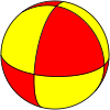
You make a good point. What is an equal-area, tessellated shape that could be used in its place?

I guess a triangle. Or one of these:

https://upload.wikimedia.org/wikipedia/commons/thumb/6/67/Sp...

https://upload.wikimedia.org/wikipedia/commons/thumb/9/9b/Sp...

Re: The largest city in each 10x10 degree latitude/longitude box

#140
post #134

Earlier quoted context omitted.

Yes with regard to the surface of the earth. Take the lines tangent to the meridian & parallel at the point of intersection. Observe these lines are perpendicular. Hence the meridian & parallel meet at a right angle.

What about the ‘boxes’ where the top edge is, er, the point at one of the poles?

Yeah not the pole of course, but you can cut them off at at ±89.999 degrees and it still works.
Post reply on HN