Live data from Hacker News

3D scanning like a pro

kurokesu.com

11–20 of 34 posts

Re: 3D scanning like a pro

#11
Another way of doing this is something like Google's project tango, right? [0][1]

So you can build and code this up (which sounds like a fun project) or if you're lazy or lack the time you can buy a $512 portable device that probably has an app or two to do 3D scanning out of the box.

Both approaches have their pros/cons but both are pretty neat and it's exciting that it should only be cheaper and easier for hobbyists to play with in the years to come.

[0] https://youtu.be/Qe10ExwzCqk?t=34 [1] https://www.youtube.com/watch?v=9_GD7kUbogk

Re: 3D scanning like a pro

#13
post #10

Great project! but the title "3D scanning like a pro" is quite a stretch. Real 3D scanning pros use something like this Leica P40 scanner: https://www.youtube.com/watch?v=GnmerVV5-T4 And produce outputs that look more like these: https://truviewglobal.leica-geosystems.com/welcome (full disclosure: I work for Leica Geosystems).

"like" meaning not "as". I was unaware anything could be done for low hundreds of dollars. That's very interesting. Looks like your system is > $100k?

Re: 3D scanning like a pro

#15
post #13
post #10

Great project! but the title "3D scanning like a pro" is quite a stretch. Real 3D scanning pros use something like this Leica P40 scanner: https://www.youtube.com/watch?v=GnmerVV5-T4 And produce outputs that look more like these: https://truviewglobal.leica-geosystems.com/welcome (full disclosure: I work for Leica Geosystems).

"like" meaning not "as". I was unaware anything could be done for low hundreds of dollars. That's very interesting. Looks like your system is > $100k?

The definition of pro varies! Here's a short rundown of 3D imaging:

Laser triangulation systems (laser stripe + turntable) will give you extremely highly detailed models at close range. You could build one for under £100 and the accuracy can easily be sub-mm. Downside is it'll only work for a short range.

Long range you're not going to beat a scanning LIDAR system like the sort that Leica offers. A comparable system from Faro (with a public price-tag) is around £30-50k depending on spec. For 'set and forget' scanning, these systems are great. They're also pretty much the only reliable solution for robust, kinda fast capture of large sites. Velodyne's automotive LIDAR (the one on the older Google cars) came on the market for around $75k. The future of 3D imaging is probably low cost MEMS scanning LIDAR, which is being bankrolled by autonomous driving.

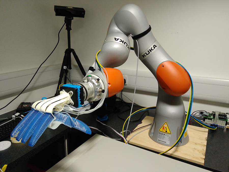
Short range you also have time of flight (Kinect 2) which is used in research and also by several large companies for commercial RnD (e.g. Ocado - http://robohub.org/wp-content/uploads/2017/02/SoMa-Ocado-RBO... - see the thing on the tripod?). My local second hand stores sells the Kinect 2 for about £25, but you need the USB adaptor (£30). Lots of companies make ToF sensors, but Microsoft really forced the price down.

Then you've got Kinect 1-like systems (Primesense), which include Google Tango (and other clones from Asus, etc). I think the Intel Realsense does something similar. These are mono cameras and an IR pattern projector. They don't work in sunlight, but are pretty good indoors. The Kinect 1 was (is) huge in 3D vision research because it was so cheap and relatively robust.

Finally you've got stereo which is the only real competitor to LIDAR outdoors. Much more dense than LIDAR, and you get true intensity information, but poor accuracy at long range. Performance is mostly dependent on the distance between the cameras. It's also the only technology you can reliably use in space. There are very few spaceborne LIDAR systems (e.g. LOLA, MOLA, etc). Stereo is the bread and butter of 3D on rovers and for planetary mapping. Prices vary, but you're looking at around £400-500 for a good pre-built stereo rig.

I think it would be unfair to say NASA and ESA (Exomars should also have stereo cams) aren't pros!

There are also several niche industries like handheld structured light scanners which can also get sub-mm accuracy. These are used for a mix of industrial inspection, capturing props for movies, etc.
Re: 3D scanning like a pro

#16
post #7
post #5

Earlier quoted context omitted.

Yup, this is called shape from silhouette. Quite a lot of research on it over the years: https://www.cvg.ethz.ch/teaching/compvis/2011/lecture/vision... EDIT: Better link

See also: Visual Structure from Motion, which I believe works off static light sources (same stuff you see in 123D Catch and similar software, this one is free though). http://ccwu.me/vsfm/ For a less detailed/easier to use process, you can also try Regard3D: http://www.regard3d.org/

Another open-source, full 3D reconstruction pipeline is COLMAP: https://colmap.github.io/

Re: 3D scanning like a pro

#17
post #10

Great project! but the title "3D scanning like a pro" is quite a stretch. Real 3D scanning pros use something like this Leica P40 scanner: https://www.youtube.com/watch?v=GnmerVV5-T4 And produce outputs that look more like these: https://truviewglobal.leica-geosystems.com/welcome (full disclosure: I work for Leica Geosystems).

Eek. 502 on your site. Might want to get that looked at.

Re: 3D scanning like a pro

#18
post #13
post #10

Great project! but the title "3D scanning like a pro" is quite a stretch. Real 3D scanning pros use something like this Leica P40 scanner: https://www.youtube.com/watch?v=GnmerVV5-T4 And produce outputs that look more like these: https://truviewglobal.leica-geosystems.com/welcome (full disclosure: I work for Leica Geosystems).

"like" meaning not "as". I was unaware anything could be done for low hundreds of dollars. That's very interesting. Looks like your system is > $100k?

Agreed. Title is accurate. It's a cheap hack that outputs results similar to what a pro can achieve. And for far, far less money.

Re: 3D scanning like a pro

#20
post #10

Great project! but the title "3D scanning like a pro" is quite a stretch. Real 3D scanning pros use something like this Leica P40 scanner: https://www.youtube.com/watch?v=GnmerVV5-T4 And produce outputs that look more like these: https://truviewglobal.leica-geosystems.com/welcome (full disclosure: I work for Leica Geosystems).

That costs 1000 times the hardware described in the article, it's not the same target audience.
Post reply on HN