Rethinking GPS: Engineering next-gen location at Uber (2018)
1–10 of 69 posts
Re: Rethinking GPS: Engineering next-gen location at Uber (2018)
#2Their internal app has ads for other Uber services? Oof.
Re: Rethinking GPS: Engineering next-gen location at Uber (2018)
#3"2018" post.
Re: Rethinking GPS: Engineering next-gen location at Uber (2018)
#4Their internal app has ads for other Uber services? Oof.
The article says "internal version of the Uber rider app", which makes me think it's some sort of internal/beta/debug build of the app that everyone else gets. In that case it makes sense that many of the features would stay the same, including stuff like ads.
Re: Rethinking GPS: Engineering next-gen location at Uber (2018)
#5(2018)
Re: Rethinking GPS: Engineering next-gen location at Uber (2018)
#6Cool, so it looks like they take the “raw” GPS location (after the GPS module does processing to spit out a lat/long) and applies statistical methods with a model of the actual 3D geometry. Seems like a smart way to improve the accuracy from “userspace”.
This reminds me of the Comma.ai project, Laika [0]. Since they have access to the raw GPS module data (Ie the actual timings of each received satellite transmitting), they can do things such as correcting for troposphere/ionosphere delays by looking up the relevant astro data as recorded by NASA and others.
Re: Rethinking GPS: Engineering next-gen location at Uber (2018)
#7L5 GPS will address the multipath-in-urban-canyon problem that Uber worked on.
Re: Rethinking GPS: Engineering next-gen location at Uber (2018)
#8L5 GPS will address the multipath-in-urban-canyon problem that Uber worked on.
I don’t know much about L5. How does it do so?
Re: Rethinking GPS: Engineering next-gen location at Uber (2018)
#9How about make your drivers use semi decent phones that don’t lag GPS?
Re: Rethinking GPS: Engineering next-gen location at Uber (2018)
#10Google explores these techniques as well. They're critical to improving accuracy in urban areas where you don't have line of sight to satellites (this is why your GNSS (AKA GPS) location is terrible whenever you're in a city). Here's [0] a cool gif visualizing the principle of GNSS ray tracing taken from one of Google's blog posts [1]. Here's an article with more information about Google's techniques [2].
[0] https://1.bp.blogspot.com/-FskvGHx-IOc/X8qtZi1GUNI/AAAAAAAAP...
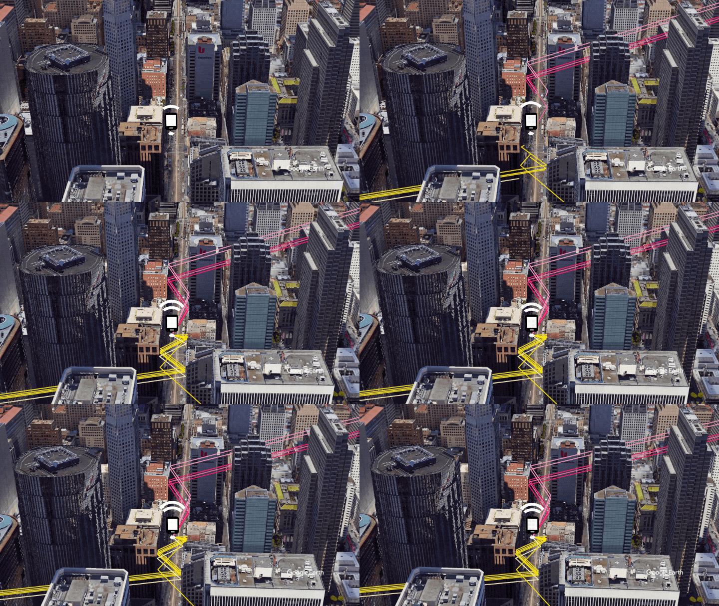
[1] https://android-developers.googleblog.com/2020/12/improving-...
[2] https://insidegnss.com/end-game-for-urban-gnss-googles-use-o...