Earlier quoted context omitted.
Read the link. The quantum magnetic locator doesnt use GPS satellites, so the "our GPS is not 100% accurate" is solved by the magnetic quantum thing... its just not available on _ your _ smartphone. Re-read my post, I believe that the real use of Lockheeds Quantum GPS is for subterranian and submarine navigation more than it is for aircraft - hoever, if we can map the magnetosphere of other planets, say, mars, then t…
But the problem is not the accuracy, it's the temporal stability. GPS is accurate enough, but it's no good if the physical locations shift over time. Most people need an up-to-date map, not just a location on a map.
Earthquake in Japan yesterday may have shifted land 1.3 meters
41–50 of 87 posts
Re: Earthquake in Japan yesterday may have shifted land 1.3 meters
#42Earlier quoted context omitted.
Read the link. The quantum magnetic locator doesnt use GPS satellites, so the "our GPS is not 100% accurate" is solved by the magnetic quantum thing... its just not available on _ your _ smartphone. Re-read my post, I believe that the real use of Lockheeds Quantum GPS is for subterranian and submarine navigation more than it is for aircraft - hoever, if we can map the magnetosphere of other planets, say, mars, then t…
But the problem is not the accuracy, it's the temporal stability. GPS is accurate enough, but it's no good if the physical locations shift over time. Most people need an up-to-date map, not just a location on a map.
Most people only use GPS for local navigation.
Re: Earthquake in Japan yesterday may have shifted land 1.3 meters
#43The amount of energy released in such events boggles the mind. Shifting cubic-kilometers of rock, in this case several hundred or even thousands of cubic-kilometers, even a few inches requires more energy than all the worlds nukes many times over. We live atop an immense heat engine, every little vibration of which could power our entire civilization for years.
It's even harder than harvesting lightnings.
He calculated that it wasn't economically viable: tons of wattage, but for such brief timespans, that it doesn't actually amount to that much on a comparative scale. The cost of building the collectors and transporting the electricity (from ocean platforms) was much higher than the cost of using other energy sources. Iirc. It wasn't exactly a serious investigation by a team of engineers, but I basically trust his conclusion.
Maybe it will be more attractive in the future after we stop using hydrocarbons?
Re: Earthquake in Japan yesterday may have shifted land 1.3 meters
#44The amount of energy released in such events boggles the mind. Shifting cubic-kilometers of rock, in this case several hundred or even thousands of cubic-kilometers, even a few inches requires more energy than all the worlds nukes many times over. We live atop an immense heat engine, every little vibration of which could power our entire civilization for years.
Re: Earthquake in Japan yesterday may have shifted land 1.3 meters
#45Earlier quoted context omitted.
But the problem is not the accuracy, it's the temporal stability. GPS is accurate enough, but it's no good if the physical locations shift over time. Most people need an up-to-date map, not just a location on a map.
GPS is only accurate up to 16 feet, and unless you are very close to an earthquake or other deformation source probably everything around you has moved by the same amount. Most people only use GPS for local navigation.
Nobody asks google maps for instructions how to move 10 miles southwest. We ask it to provide a route to a specific latitude and longitude, that's global navigation and that, of course, doesn't work if the place you want to get to has gotten new coordinates overnight.
Re: Earthquake in Japan yesterday may have shifted land 1.3 meters
#46This is a very sad example of land movement and it's a tragedy that people have died in the aftermath and recovery effort. But it's also an important reminder that our super accurate GPS measurements are not 100% reliable over time. The earth moves. Either in jumps like this or fairly constantly if it's somewhere like Australia [0] 0 - https://www.nytimes.com/2016/09/24/world/what-in-the-world/a...
The GPS measurements are 100% reliable. Think of it like getting GPS co-ordinates while on a boat - it's the boat that moves.
A point of interest on land doesn't stay at the same latitude/longitude/altitude because land is a tectonic plate "boat" floating on the mantle.
Close to the earthquake faultplane, land crumples and shears sideways and up/down. Plus secondary effects of the shaking: landslides, settlement, liquifaction.
Finally: I think it helps to remember that earthquakes are fault _planes_. Talk of epicentres and depths and faultlines often misleads our intuitions. For one of the Christchurch earthquakes my parents were about a kilometre away from the faultline (where the faultplane met the surface) and many kilometres away from the epicentre (which is just a synthetic average point), but the faultplane actually was relatively close to them somewhere underneath their home.
Also images of cracks in roads are often extremely misleading. They tend to be spectacular subsidence and are not the faultline. The actual faultline is usually not so photographic and less likely to have great photos early on. Media choses photos for their emotional appeal - not because they are a good approximation for the truth.
Re: Earthquake in Japan yesterday may have shifted land 1.3 meters
#47Earlier quoted context omitted.
It's even harder than harvesting lightnings.
I'm not sure about that. Drill some holes, pump some water, and geothermal power straight to the grid can be done. Harvesting lighting would require innumerable towers and even would require some trickery to get it hooked up to our power grids.
Re: Earthquake in Japan yesterday may have shifted land 1.3 meters
#48Earlier quoted context omitted.
It’s not just a software problem, you also need to know how the earth is being deformed which is far more difficult than you might think.
Not necessarily. Place a grid of receivers in fixed locations and observe their reported position. That grid is then the transform you need between the map when they were placed and the current state of the globe. A question would be how many you need, but these movements are on a large scale and receivers are dirt cheap.
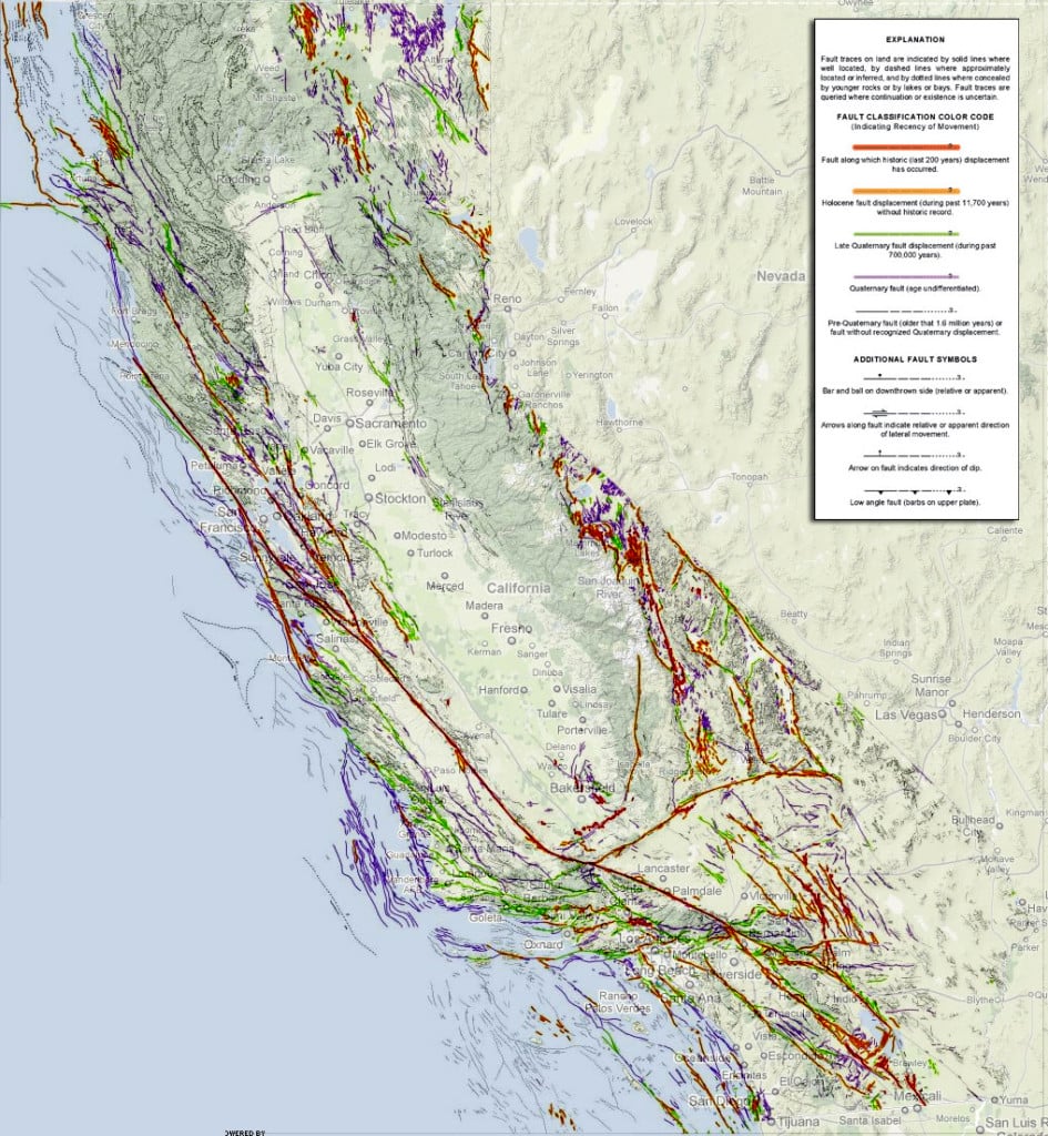
https://strangesounds.org/wp-content/uploads/2014/09/earthqu...
What you really want is censers placed based on the underlying geology rather than a grid and then to combine that with a model of the geology.
Re: Earthquake in Japan yesterday may have shifted land 1.3 meters
#49Earlier quoted context omitted.
GPS is only accurate up to 16 feet, and unless you are very close to an earthquake or other deformation source probably everything around you has moved by the same amount. Most people only use GPS for local navigation.
GPS is much better than 16 feet these days. Nobody asks google maps for instructions how to move 10 miles southwest. We ask it to provide a route to a specific latitude and longitude, that's global navigation and that, of course, doesn't work if the place you want to get to has gotten new coordinates overnight.
And of course, satellite navigation is worsened by the urban canyon of buildings, terrain, trees etc so super accurate navigation also uses local cell towers, which are also shifting by the same magnitude and direction as you and your local destination.
Ultimately people only really need to get to the rough city block of where they need to be, and so as long as buildings are not shifting hundreds of feet a year it is mostly not noticeable.
Re: Earthquake in Japan yesterday may have shifted land 1.3 meters
#50This is a very sad example of land movement and it's a tragedy that people have died in the aftermath and recovery effort. But it's also an important reminder that our super accurate GPS measurements are not 100% reliable over time. The earth moves. Either in jumps like this or fairly constantly if it's somewhere like Australia [0] 0 - https://www.nytimes.com/2016/09/24/world/what-in-the-world/a...
> our super accurate GPS measurements are not 100% reliable over time The GPS measurements are 100% reliable. Think of it like getting GPS co-ordinates while on a boat - it's the boat that moves. A point of interest on land doesn't stay at the same latitude/longitude/altitude because land is a tectonic plate "boat" floating on the mantle. Close to the earthquake faultplane, land crumples and shears sideways and up/do…
I'm not sure this is a good metaphor. When doing high-accuracy GNSS (GPS) survey work, a static reference station is typically used to help correct errors from the GPS measurements themselves.
If GPS was 100% consistent and reliable, differential correction wouldn't be a common and often-required technique: