Live data from Hacker News

Hello, This Is London Rising: 3D Printing Maps from LIDAR Data

aeracode.org

31–40 of 43 posts

Re: Hello, This Is London Rising: 3D Printing Maps from LIDAR Data

#31
Really great write up, with lots of clear details of every aspect.

I always lament that STL was the format 3D printing software ended up with (essentially a bag of triangles, usually in text format). Far better if slicers could take a true mesh, and not have to guess if coincident points on separate triangles actually amount to the same vertex, except of course for places where it doesn't!
Re: Hello, This Is London Rising: 3D Printing Maps from LIDAR Data

#33
You can collect LIDAR data for your own favorite part of city by using this $250 device and a cheap drone like 3DR Solo:

http://www.lightware.co.za/shop/en/drone-altimeters/51-sf11c...

The main issue you will face is permission to fly drone at 100m or so. In US there are way too many laws to do this.

It looks like aircraft was flying at 200m for above data. London's tallest structure are at 300m+ so this is not doable in all areas.

Also note that software like pix4d and AutoDesk 360 can construct 3D models purely from drone images or videos. I'm not sure how much better LIDAR models are compared to models from structure from motion.

Re: Hello, This Is London Rising: 3D Printing Maps from LIDAR Data

#34
One thing the author doesn't mention on 3D printing issues, is extruder retraction settings (essentially pulling back the filament from the hot end slightly before the head moves to a new path, thus limiting strings of fine filament between them)

Re: Hello, This Is London Rising: 3D Printing Maps from LIDAR Data

#35
post #23
post #17

That's really cool. Wish it was printed in colour :) If LIDAR data isn't available, you can do pretty detailed 3D mapping with a regular camera and UAV, using photogrammetry/structure from motion. A Phantom or almost anything that flies with a reasonable camera will do. Of course the better camera you use, the better the results. Flight restrictions over populated areas apply, check your local legislation :) commerci…

Color 3D printing is pretty pricey still. For something of that scale you'd be looking at several thousand dollars, even breaking it down into small individual pieces.

Using clever hollow boxes can bring the prices down significantly: http://www.shapeways.com/product/PCVV6V9G2/y-garn-relief

Re: Hello, This Is London Rising: 3D Printing Maps from LIDAR Data

#39
post #35
post #23

Earlier quoted context omitted.

Color 3D printing is pretty pricey still. For something of that scale you'd be looking at several thousand dollars, even breaking it down into small individual pieces.

Using clever hollow boxes can bring the prices down significantly: http://www.shapeways.com/product/PCVV6V9G2/y-garn-relief

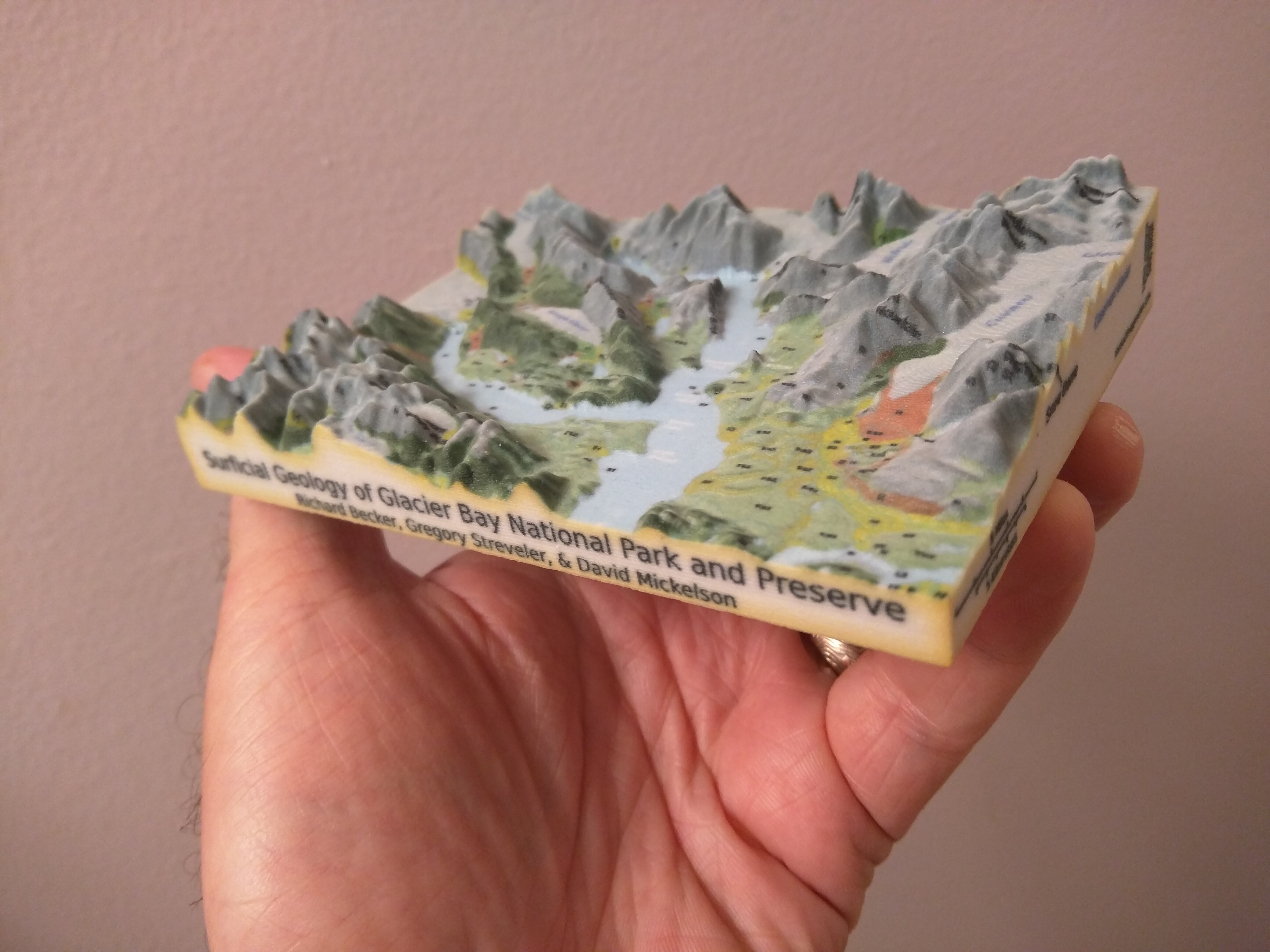
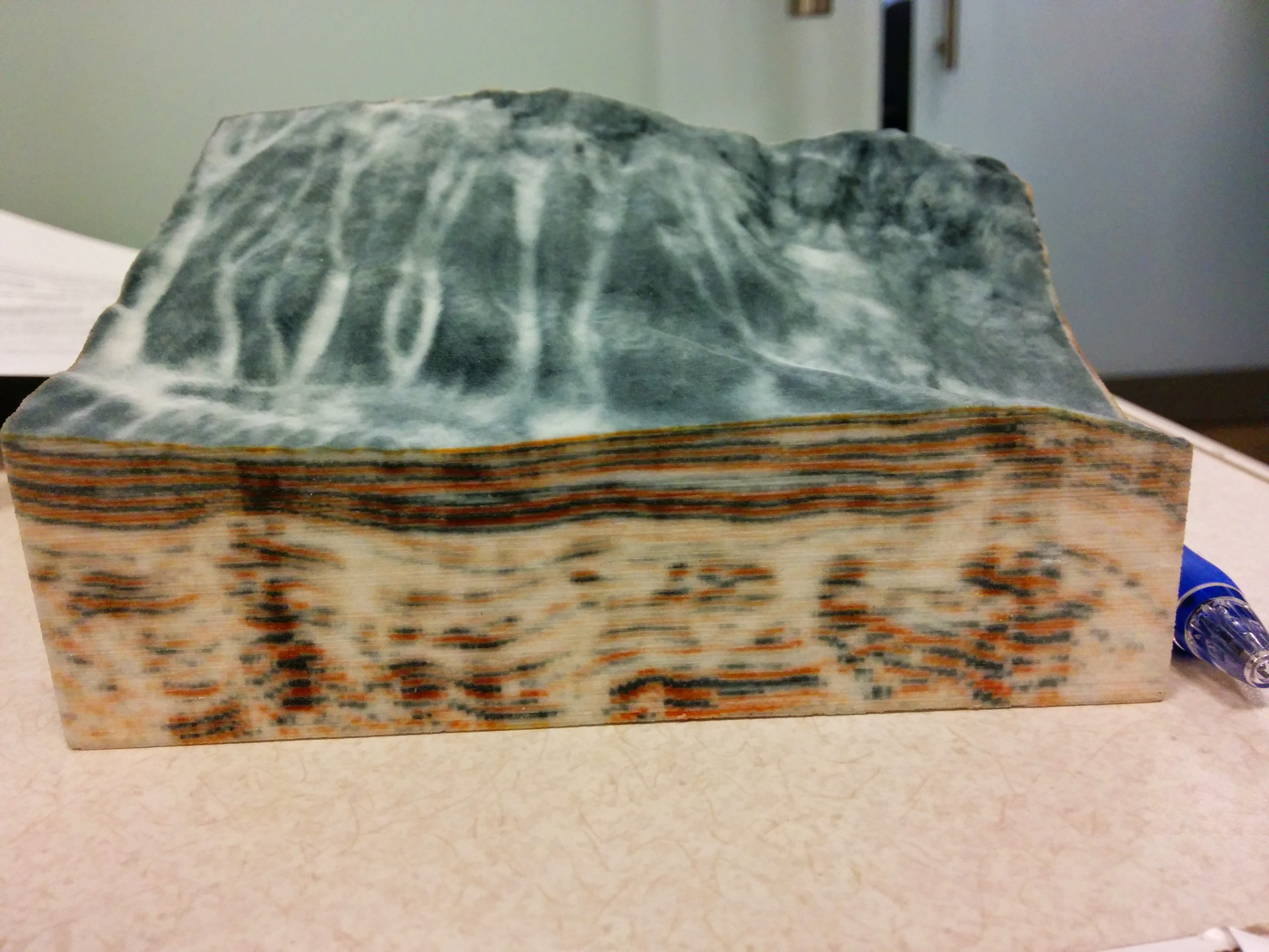
It's still pricey. Making it hollow only helps if it's tall. For color 3D printing, the material is gypsum powder (well, there is CMYK filament now, but I haven't looked into it much). You need considerably thicker walls, etc. Furthermore, the cost is as heavily influenced by machine space as by the amount of material used.

For example, this was ~$100. https://raw.githubusercontent.com/joferkington/scipy2015-3d_... I tried uploading and pricing a "hollow box" version, but it saved less than $5.

However, for this one, using a "hollow box" saved ~30%, (it's a comparable size, but much taller): https://raw.githubusercontent.com/joferkington/scipy2015-3d_...

Re: Hello, This Is London Rising: 3D Printing Maps from LIDAR Data

#40
post #23
post #17

That's really cool. Wish it was printed in colour :) If LIDAR data isn't available, you can do pretty detailed 3D mapping with a regular camera and UAV, using photogrammetry/structure from motion. A Phantom or almost anything that flies with a reasonable camera will do. Of course the better camera you use, the better the results. Flight restrictions over populated areas apply, check your local legislation :) commerci…

Color 3D printing is pretty pricey still. For something of that scale you'd be looking at several thousand dollars, even breaking it down into small individual pieces.

Maybe it would be possible (for this concept) to just color the top layer using an overlay of data from OpenStreetMap or google maps. Probably would require a lot of tweaking to get the alignment right, but it would look fantastic.

I suppose no such ink/coloring-the-top-layer thing exists.

Post reply on HN