As someone who grew up with these maps when my parents went hiking in the alps with us kids, I get so many good feelings from them.
Eduard: Swiss-Style Relief Shading for Maps Using Machine Learning
21–30 of 77 posts
Re: Eduard: Swiss-Style Relief Shading for Maps Using Machine Learning
#22I heard there is some work going on to import the new extremely high quality relief data from swisstopo into openstreetmap. They are even supposed to be accounting for buildings and forests in order to get the ground level accurately. Not sure where they are right now.
Re: Eduard: Swiss-Style Relief Shading for Maps Using Machine Learning
#23In Swiss-Style Relief shading, the light comes from North West, which is impossible in the northern hemisphere. This makes sunny south facing slopes shaded and shaded north facing slopes light. Legend says that this was an intentional design decision, because right handed people usually have their desk lighting on the top left of their desk, giving the map a 3D like appearance. Here's an article on the topic (german…
But if you try using the factually correct angle (light from some angle in the south), the result is misleading to the eye.
Re: Eduard: Swiss-Style Relief Shading for Maps Using Machine Learning
#24Is there an easy way to see that this problem is complicated enough to require a neural network? I'm a noob in graphics, but this problem seems like it shouldn't be that difficult to require a neural net.
We have been doing it "since forever" without Neural Networks.
Check Stefan "der-stefan" Erhardt's instructions to create your own OpenTopoMap service and map tiles from iron: you download elevation data and process them into shaded elevations - https://github.com/der-stefan/OpenTopoMap
Re: Eduard: Swiss-Style Relief Shading for Maps Using Machine Learning
#25I don't get it why ML is needed. Just download a DEM (for example, an aerial LIDAR map or SRTM), import it in QGIS along with your base map raster, choose the appropriate shading parameters and combine the two with appropriate blending.
edit: and if you're feeling fancy, you can render the relief shading in blender: https://somethingaboutmaps.wordpress.com/2017/11/16/creating...
Re: Eduard: Swiss-Style Relief Shading for Maps Using Machine Learning
#26Is there an easy way to see that this problem is complicated enough to require a neural network? I'm a noob in graphics, but this problem seems like it shouldn't be that difficult to require a neural net.
It does look like it would be doable without neural networks. My guess (having read their paper but not worked in the domain) is that it would be doable but requires a lot of iterations, tweaking parameters and dealing with corner cases. That would give you something running almost instantaneously but it would take a year to develop with tight feedback from domain experts. Or, you can throw a (relatively standard for…
The chances of the problem not having being already tackled with deterministic algorithms is the thinnest - and in fact, yes, there do exist tools, as expected.
See the sections about 'hillshade' at the OpenTopoMap "from scratch" instructions, at https://github.com/der-stefan/OpenTopoMap/blob/master/mapnik...
Re: Eduard: Swiss-Style Relief Shading for Maps Using Machine Learning
#27Is there an easy way to see that this problem is complicated enough to require a neural network? I'm a noob in graphics, but this problem seems like it shouldn't be that difficult to require a neural net.
There's a nice example on that page with an overlayed relief shaded map and the original. Can you explain in English step by step how you would turn one into the other manually using something like photoshop?
If you read the text of the site or the paper: it needs a digital elevation model (i.e. a height map) to create the shaded relief. It does not ingest graphical maps and does the relief, it needs a discretized map of height data, such as lidar (which can be downloaded for any place on earth with 1m resolution).
Re: Eduard: Swiss-Style Relief Shading for Maps Using Machine Learning
#28I don't get it why ML is needed. Just download a DEM (for example, an aerial LIDAR map or SRTM), import it in QGIS along with your base map raster, choose the appropriate shading parameters and combine the two with appropriate blending. edit: and if you're feeling fancy, you can render the relief shading in blender: https://somethingaboutmaps.wordpress.com/2017/11/16/creating...
> Many standard shading algorithms exist for creating shaded reliefs, some can easily be found in applications like ArcGIS and QGIS but they are simply not expressive enough (see our paper for examples). Creating these reliefs is partially an art form rather than a simple illumination problem, so trying to encode the 'human-ness' into step-by-step algorithms is simply too difficult. This is where ML enters the picture.
Re: Eduard: Swiss-Style Relief Shading for Maps Using Machine Learning
#29I don't get it why ML is needed. Just download a DEM (for example, an aerial LIDAR map or SRTM), import it in QGIS along with your base map raster, choose the appropriate shading parameters and combine the two with appropriate blending. edit: and if you're feeling fancy, you can render the relief shading in blender: https://somethingaboutmaps.wordpress.com/2017/11/16/creating...
The paper does exactly that: download a DEM height map and do shading from that. What they argue is that you can customize the amount of detail of the terrain to make it look hand-made (since an artist shading by hand wouldn't be able to interpret small variations and flat areas of the contour plot as well).
Re: Eduard: Swiss-Style Relief Shading for Maps Using Machine Learning
#30In Swiss-Style Relief shading, the light comes from North West, which is impossible in the northern hemisphere. This makes sunny south facing slopes shaded and shaded north facing slopes light. Legend says that this was an intentional design decision, because right handed people usually have their desk lighting on the top left of their desk, giving the map a 3D like appearance. Here's an article on the topic (german…
But if you try using the factually correct angle (light from some angle in the south), the result is misleading to the eye.
Sometimes, but not always: it likely depends on the style of the map and how accurate it is as well I think, and maybe depends on people's perception: thanks to computer UI buttons from the 90s, it is common for upper and left-most surfaces/bevels to be lighter, so there is some assumption there.
i.e. I think this type of thing: https://cartographart.com/minimalist/iceland_2_5k_orth_occlu...
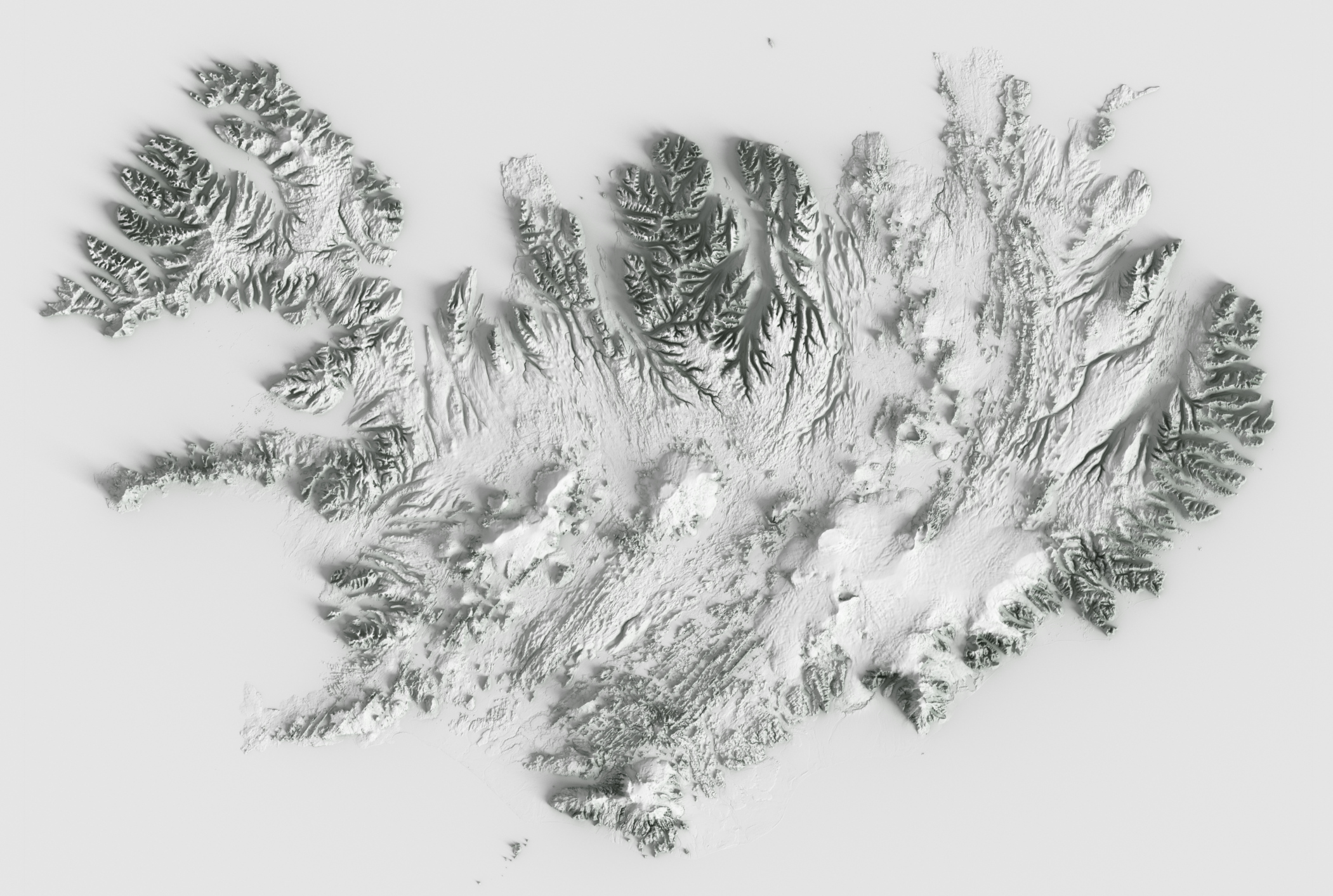
works well, but that's not really a detailed map with normal cartographic details like roads and towns on overlaid with relief shading, so difficult to say.
However even if you do try and do it accurately, places on the equator are likely troublesome: i.e. the whole of Africa or something: you're unlikely to want to do the fully-accurate thing there of above the equator (or where the sun is) being shadowed from the south and below the equator being shadowed from the north, it'll likely be confusing in the middle.