In case the dev is reading these: typo in bullet 6 at bottom >It is recommended to use a separate GPS device to record your tracks. This would save beattery life of your iOS device and avoid GPS signal loss when Internet connection is unavailable. Otherwise, looks batteful.
Fog of World
111–120 of 160 posts
Re: Fog of World
#112I love this idea. Unfortunately my GPX export from Foursquare doesn't seem to show up in the application. I used this utility for what it's worth: http://etgps.net/gps/4sq/
Re: Fog of World
#113I love this idea. Unfortunately my GPX export from Foursquare doesn't seem to show up in the application. I used this utility for what it's worth: http://etgps.net/gps/4sq/
Re: Fog of World
#114Thank God this costs $5 dollars. I might have even gone as high as $10. To all those that think 5 bucks is too much: for you to actually get any value out of this app you have to use it over a non-significant portion of your life. We're talking on the timescale of years; I find it hilarious that 1 dollar is fine but 5 whole dollars is outrageous.
So it's just an app that keeps track of where you've been?
Re: Fog of World
#115Re: Fog of World
#116Earlier quoted context omitted.
95% of existing tourism spending. There's a big untapped market out there.
It's true. The stuff off the beaten path usually hasn't been commercialized. Thus it makes sense why it would only account for 5% of the spending
Re: Fog of World
#117Re: Fog of World
#118Correction — "Know the Area You Have Explored Around the World, Around A Continent, Or Even Around A Country, Where Your Phone Had A Full Battery, GPS Was Available, And There Was Reliable Electricity For Recharging!" This is dumb. Any given user is going to have massive holes in their map, which, at least according to my experience, will be the best parts of their trips — the parts where they didn't have their phone…
A lot of seriously dedicated "off-the-beaten-track" types will have solar chargers for their iPhones (or whatever), GPS works everywhere except near US Military Bases. I hope they've been judicious in their use of power while in the background. It seems like a cool idea to me. I can easily imagine simply trying to fill in the area I live in much the same way as I would explore nooks and crannies in dungeons maps.
Or just switch their phones off, unless they need help, if you are lucky enough to have reception. The "off-the-beaten-track" types that I know use paper maps, or a Garmin GPS that lasts two days while continually using maps on two AA batteries, that can handle occasional drops and water.
I like hiking every now and then, but do not really see use for this. What does it give me over uploading my tracks on the many 'show my last hike track' websites?
Besides that, I can really see this being harmful for nature, people destroying vulnerable plants and animals just to remove a particular piece of fog. It's as sad as people completely 'flattening' a some spot to find a particular Geocache.
(I do like responsible Geocaching, but people should be made aware of damage that they could make.)
Re: Fog of World
#119This is neat, I wish Google Latitude had it. For that matter, I wish Google Latitude had any useful visual representation of the 2+ years' worth of location data I've been feeding it. =|
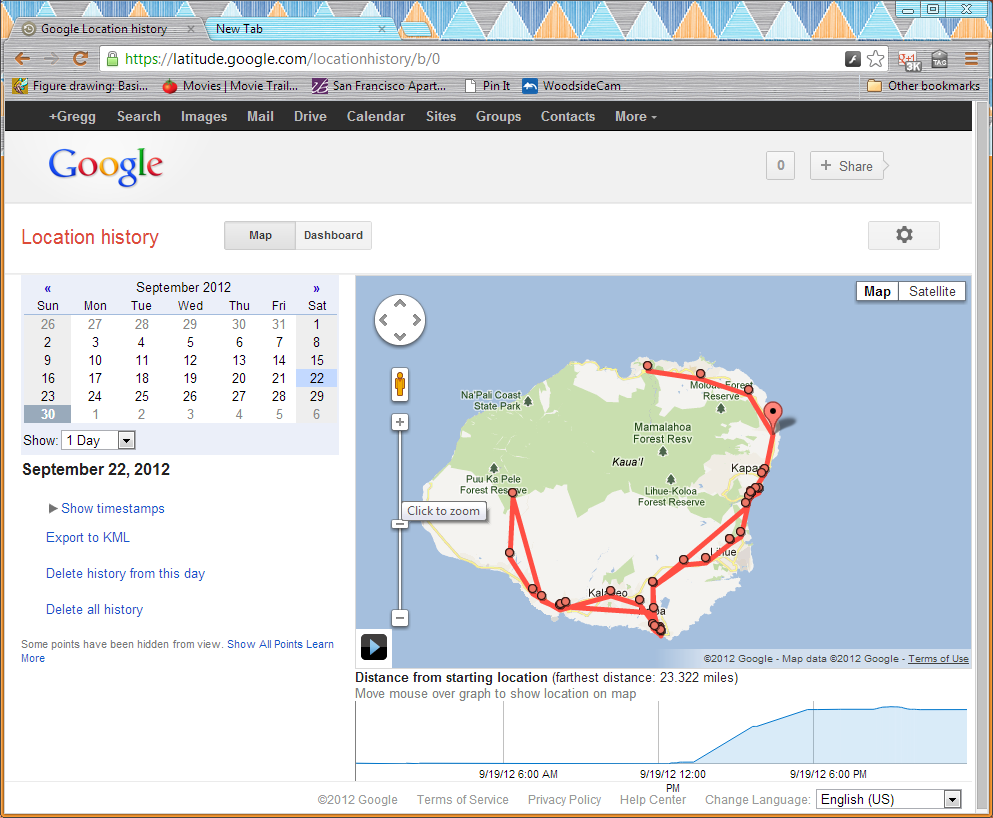
Here's a screenshot from my vacation a few days ago.
Re: Fog of World
#120This is neat, I wish Google Latitude had it. For that matter, I wish Google Latitude had any useful visual representation of the 2+ years' worth of location data I've been feeding it. =|
Um, have you actually tried using the Web interface? Here's a screenshot from my vacation a few days ago. http://greggman.com/downloads/examples/latitude-maps.png