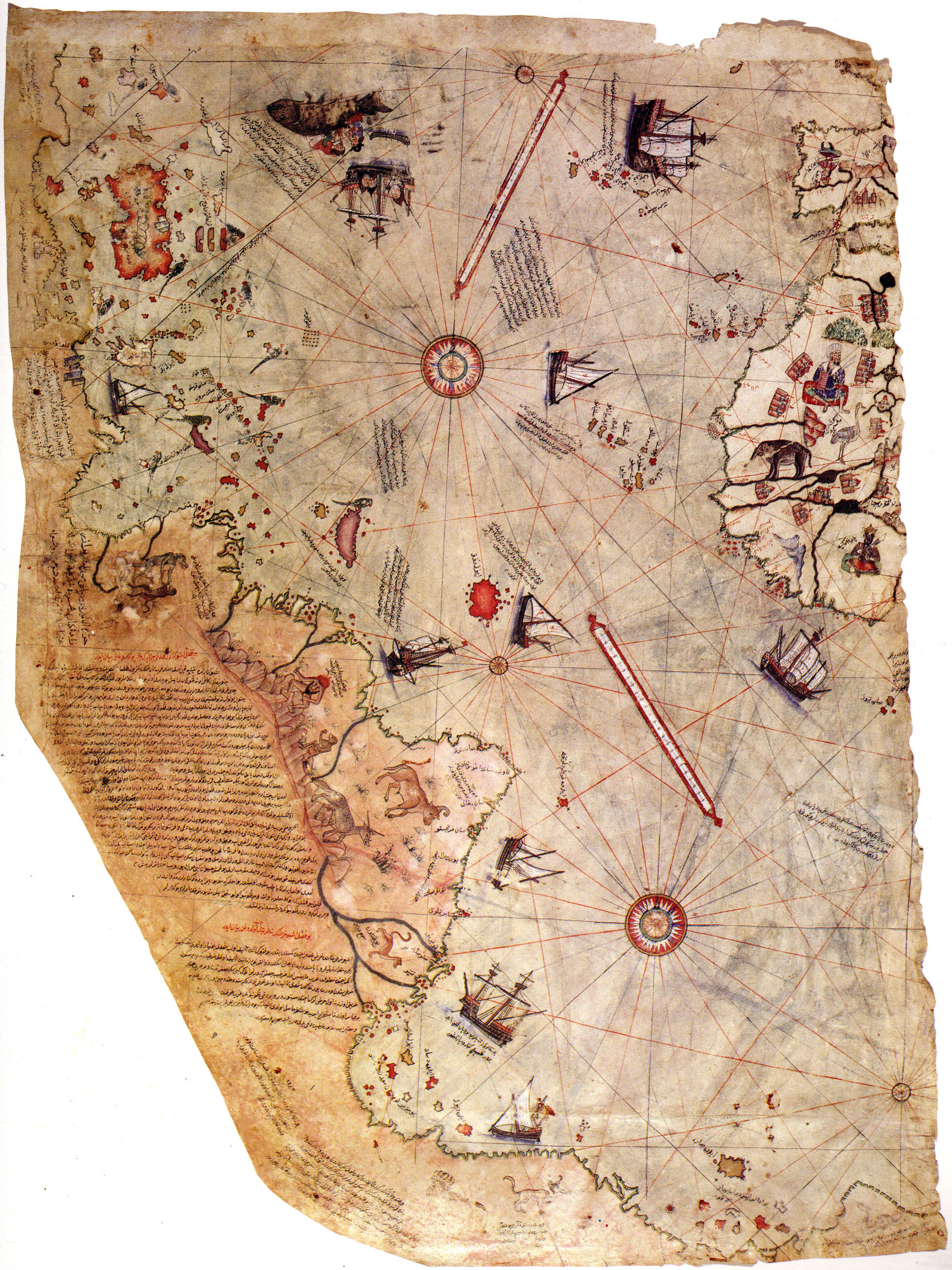
Piri Reis Map
en.wikipedia.org
Piri Reis Map
1–10 of 13 posts
Re: Piri Reis Map
#2Text copied (incompletely) from here, I believe: http://glenavalon.com/pirireis.html
But even better is: http://en.wikipedia.org/wiki/Piri_Reis_map
Which links to (comparison to modern accurate maps): http://www.uwgb.edu/dutchs/pseudosc/piriries.htm
Re: Piri Reis Map
#3A site explaining the mystery: http://www.diegocuoghi.com/Piri_Reis/PiriReis_eng.htm
Re: Piri Reis Map
#4In BBC's Museum Mysteries docus, in the Topkapı Palace episode, they offer their theory for this.
They think that Piri Reis (commander of the navy at that time) obtained maps from ships that passed through the Bosphorus. He was then able to draw a current map of the world from all the diverse information.
They basically explored the world without ever leaving home.
Re: Piri Reis Map
#5Columbus, when he sailed West, used as reference a number of maps sourced from the Chinese empire (among others)... In particular, he might have used the 1492 Martin Behaim globe as his primary reference. [0]
The Martin Behaim globe shows Cipangu, which is actually the Japanese island of Kyushu as depicted by the Chinese. It also show part of Indonesia. Worth noting is that when Columbus sailed West, he was not looking for "the Indies", but for Cipangu, described by Marco Polo as "the land of gold". [1]
So it seems that Piri Reis compiled recent south-american data together with older asia-pacific data. The so-called "antartica" part of the Piri reis map appears to match Java as shown on world maps of the same period. Mystery solved, I guess... (check for yourself by comparing the Piri Reis map and the Martin Behaim globe). This is supported by the fact that the Piri Reis map also seems to show Cipangu off North America, and describes the "antartica" land at the bottom as a warm land.
Anyway, the outlandish claims of the article about the extraordinary accuracy of the map are complete BS. Check it yourself. [2]
[0] https://en.wikipedia.org/wiki/Names_of_Japan#mediaviewer/Fil...

[1] http://www.japantimes.co.jp/life/2008/07/27/to-be-sorted/cip...
[2] https://upload.wikimedia.org/wikipedia/commons/7/70/Piri_rei...
Re: Piri Reis Map
#6spam blog, just google any paragraph and you will see
Re: Piri Reis Map
#7In BBC's Museum Mysteries docus, in the Topkapı Palace episode, they offer their theory for this. They think that Piri Reis (commander of the navy at that time) obtained maps from ships that passed through the Bosphorus. He was then able to draw a current map of the world from all the diverse information. They basically explored the world without ever leaving home.
I LOVE Topkapı Palace, it's gorgeous. Have you been?
I had an amazing tour guide who, among many other things, explained how everything had two layers of security (at least) built in. For instance, eunuchs in the Harem were always black just in case the castration was botched - that way, you could still tell the child was not the Sultan's. A bit more here: http://jmilton6000.wordpress.com/2006/11/23/the-harem-and-th...
Talk about redundancy.
Re: Piri Reis Map
#8another mystery: https://www.saudiaramcoworld.com/issue/197704/al-idrisi.and....
Re: Piri Reis Map
#9Text copied (incompletely) from here, I believe: http://glenavalon.com/pirireis.html But even better is: http://en.wikipedia.org/wiki/Piri_Reis_map Which links to (comparison to modern accurate maps): http://www.uwgb.edu/dutchs/pseudosc/piriries.htm
Thanks! We've changed the url (from http://luis40pr.wordpress.com/2014/01/15/world-mysteries-the...) and unkilled the post, since users were probably flagging the source rather than the story.
Re: Piri Reis Map
#10Side note: I used to play a game called "New Horizon" (or known as the Uncharted Waters 2 [1]). One of the characters in the game goes by the name of Philly Reis, from Turkey. His level is off the chart (Sailing, Fighting, etc).
Didn't know there's actually someone by the name of Piri Reis from Turkey in the real world!
[1]: http://en.wikipedia.org/wiki/Uncharted_Waters#Uncharted_Wate...