Here's the loop from today
https://atlas.niu.edu/analysis/radar/midwest/midwest_radar_b...
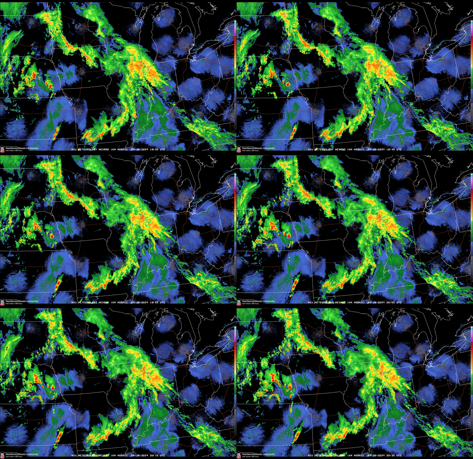
What is going on with US weather radar today?
atlas.niu.edu
1–10 of 16 posts
https://atlas.niu.edu/analysis/radar/midwest/midwest_radar_b...
What is going on with US weather radar today?
atlas.niu.edu
It's quite possible there is some lower altitude fog/precipitation/something that is only visible to the radar at it's lower tilt angles. But that's just speculation.
I just wish we even had a radar where I live.
I haven't seen enough history to know if that's normal or not, but I can tell you that the center of each of those blue "clouds" is a nexrad radar station. It's view is a wide cone from the ground upwards (technically a set of cones from each of the radar's tilt angles). It's quite possible there is some lower altitude fog/precipitation/something that is only visible to the radar at it's lower tilt angles. But that's…
The National Weather Service has a good brief explainer: https://www.weather.gov/iwx/wsr_88d
They also have an interesting PDF covering some of the more unique signatures you might see, though it's not exhaustive: https://www.weather.gov/media/btv/research/Radar%20Artifacts...
I haven't seen enough history to know if that's normal or not, but I can tell you that the center of each of those blue "clouds" is a nexrad radar station. It's view is a wide cone from the ground upwards (technically a set of cones from each of the radar's tilt angles). It's quite possible there is some lower altitude fog/precipitation/something that is only visible to the radar at it's lower tilt angles. But that's…
One of my weird hobbies is radar chasing storms, and all of that stuff is completely normal. NEXRAD is very sensitive, especially when it's in clear air mode (it has different modes depending on if it's raining in the area) and can pick up things like dust, birds, bats, and insects. There's also ground clutter from things like buildings, wind farms, and even cars. The National Weather Service has a good brief explain…
I haven't seen enough history to know if that's normal or not, but I can tell you that the center of each of those blue "clouds" is a nexrad radar station. It's view is a wide cone from the ground upwards (technically a set of cones from each of the radar's tilt angles). It's quite possible there is some lower altitude fog/precipitation/something that is only visible to the radar at it's lower tilt angles. But that's…
Current operating modes: https://www.roc.noaa.gov/branches/operations-branch/current-...